
Regional Map & Directions to Harman’s
Find Harman’s Log Cabin Resort in Hopeville Canyon, West Virginia, along the North Fork South Branch Potomac River. Dolly Sods Wilderness lies west of us, with the Monongahela National Forest extending through the surrounding mountain landscape.
Use this regional map to compare the drive from your city and see the main roads into the North Fork Valley. The close-up shows the river and nearby forest landscape.
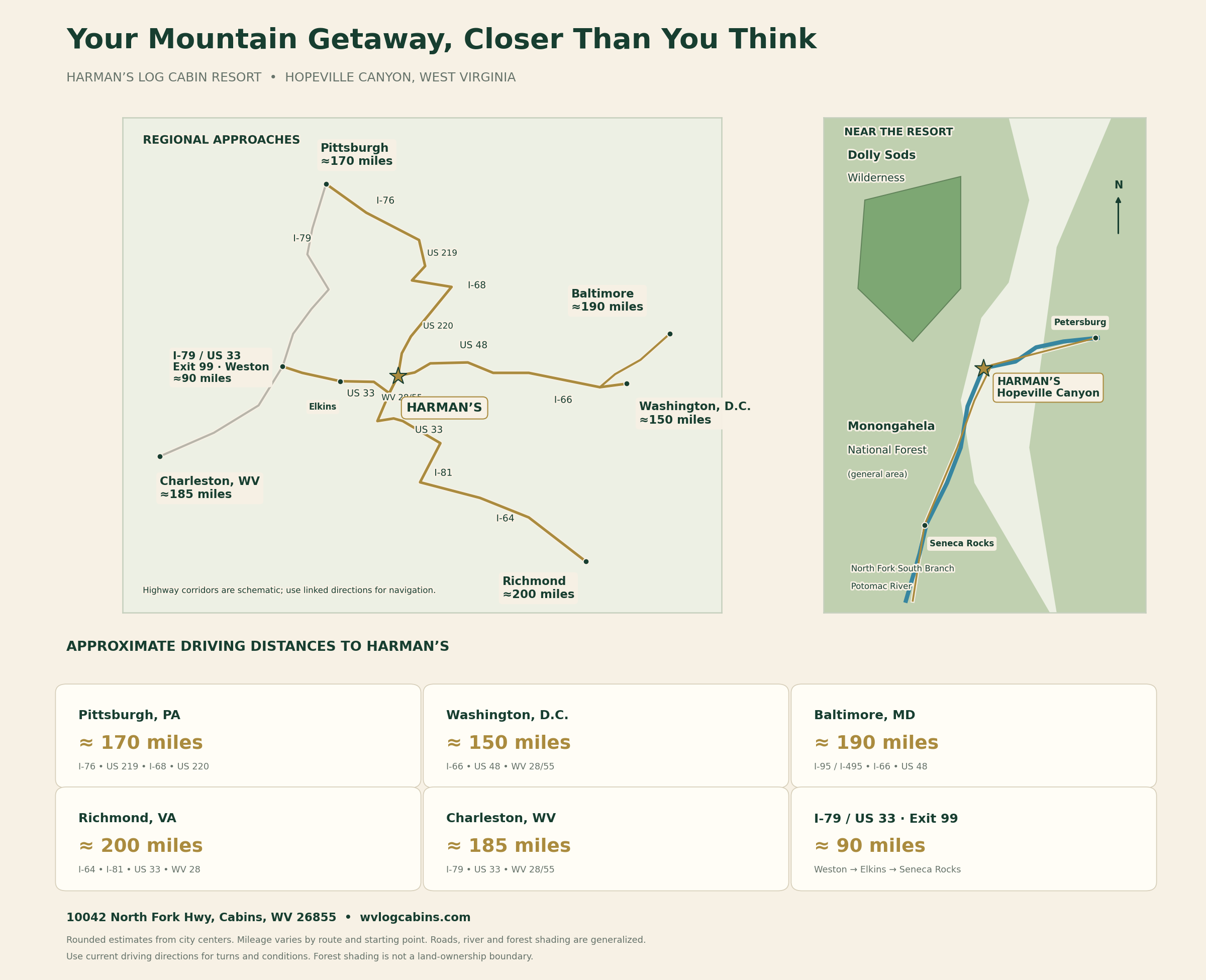
Approximate Driving Distances
These rounded estimates are from city centers or the Weston approach and vary by starting point and route. The roads below summarize major approaches; use the directions links for current routing, connecting roads and conditions. Some routes include tolls.
| Starting point | Distance to Harman’s | Major approach roads | Plan your drive |
|---|---|---|---|
| Pittsburgh, PA | About 170 miles | I-76, US 219, I-68 and US 220 | Directions |
| Washington, DC | About 150 miles | I-66 and US 48 toward Moorefield; WV 28/55 for the final approach | Directions |
| Baltimore, MD | About 190 miles | I-95 / I-495, I-66 and US 48 | Directions |
| Richmond, VA | About 200 miles | I-64, I-81 and US 33; WV 28 north at Seneca Rocks | Directions |
| Charleston, WV | About 185 miles | I-79 north to Exit 99, then US 33 east through Elkins and WV 28/55 | Directions |
| I-79 / US 33, Weston, WV | About 90 miles | Exit 99 → US 33 east → Elkins → Seneca Rocks → WV 28 north | Directions |
Coming from I-79?
Use Exit 99 at US 33 near Weston. Follow US 33 east toward Buckhannon and Elkins, continue toward Seneca Rocks, then take WV 28 north / WV 55 east along the North Fork to Harman’s.
Resort address: 10042 North Fork Hwy, Cabins, WV 26855. Save your directions before entering the mountains because cell service around the resort is limited.
Explore the cabin property map · Explore nearby attractions and hikes