Scenic Views & Adventure: The Best Dolly Sods Hikes
- Categories:
- Wellness
- Hiking Trails in West Virginia
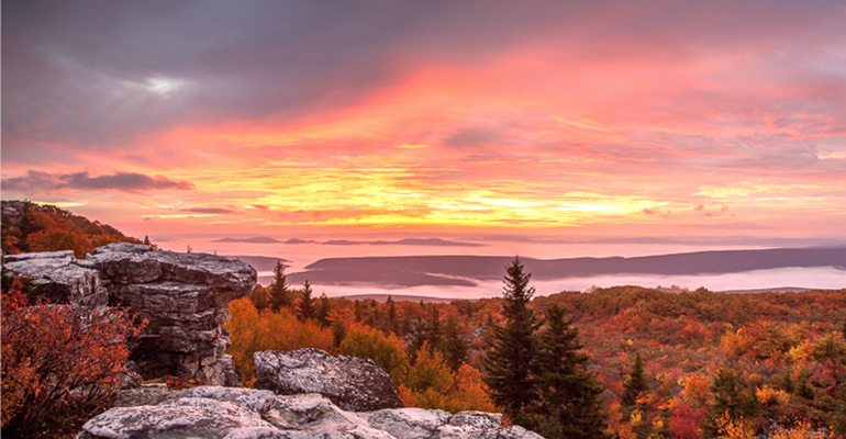
We’ve rounded up the best Dolly Sods hikes that all hikers should try. Dolly Sods—also known as Dolly Sods Wilderness—resides within the Allegheny Mountains of Monongahela National Forest. The area provides phenomenal views of West Virginia’s natural landscape, making these trails perfect for West Virginia fall foliage viewing and summer adventure.
The trails listed below range in difficulty from easy to difficult and length. But most are perfect for day hikes and only require your hiking gear and a will for adventure. No matter your skill level or preferences, you’ll have no problem finding the right Dolly Sods hiking trail to enjoy!
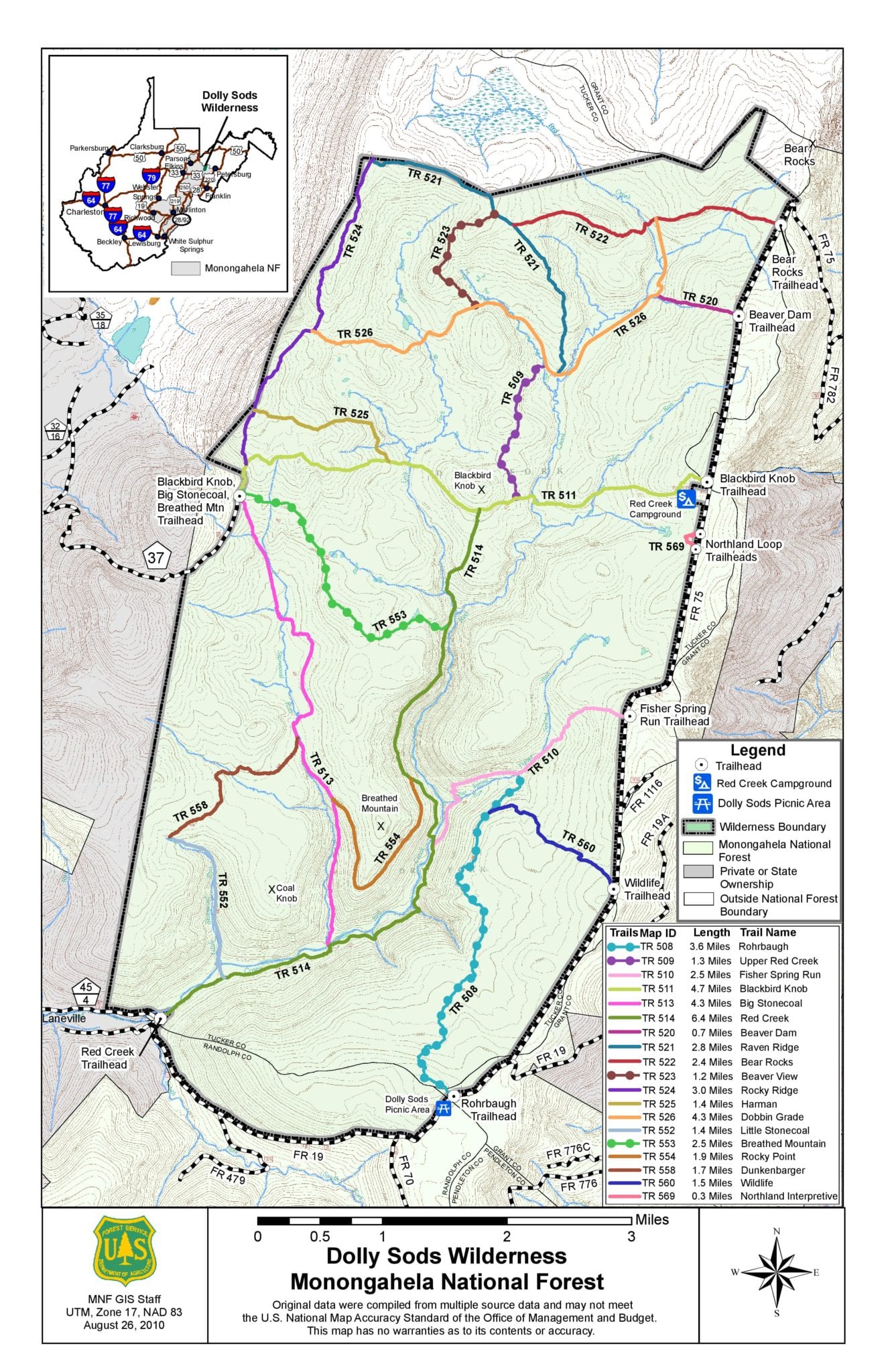 The Top Dolly Sods Hiking Trails
 The Top Dolly Sods Hiking Trails
Beaver Dam Trail
Distance: 0.7 miles
Difficulty: Easy
Max Elevation: 4,060 feet
At just 0.7 miles, Beaver Dam Trail is one of the shortest trails in Dolly Sods Wilderness. The hike is moderately trafficked and features beautiful wildflowers. Great for all skill levels, this trail is typically used for nature trips, walking, and birding during the warmer months. The trailhead begins at the northeast corner of Monongahela National Forest, eventually connecting to Dobbin Grade Trail. Dogs can also enjoy Beaver Dam Trail, but must remain on a leash.
Upper Red Creek Trail
Distance: 1.3 miles
Difficulty: Easy to Moderate
Max Elevation: 3,860 feet
Encompassing 1.3 miles of scenic hiking, Upper Red Creek Trail is an enjoyable, quick hike. The area is surrounded by lush forest and impeccable views of valleys and hills. Towards the north end of the hike, you’ll run into the Red Creek. This hike is great for all skill levels, with most of the hike traversing through the valley.
Harman Trail
Distance: 1.4 miles
Difficulty: Easy to Moderate
Max Elevation: 4,156 feet
Harman Trail is a connector between Blackbird Knob Trail and Rocky Ridge Trail. Encompassing 1.4 miles, Harman Trail is a handy loop for hikers. Attractions include rivers, creeks, and plenty of wildflowers like the mountain laurel.
Bear Rocks Trail
Distance: 2.4 miles
Difficulty: Easy to Moderate
Max Elevation: 4,072 feet
This easy to intermediate trail features many gorgeous plants, including wildflowers and fruit shrubs. Bear Rocks Trail is accessible year-round, making it a great hike for fall foliage viewing and summer hikes. Dogs are welcome but must be leashed. With little elevation and limited hiking hazards, this Dolly Sods hike is great for families. The trail connects with Raven Ridge Trail and Dobbin Grade Trail.
Breathed Mountain
Distance: 2.5 miles
Difficulty: Moderate
Max Elevation: 3,927 feet
This Dolly Sods hike boasts several creeks and river views, creating gentle sounds of rushing water. Breathed Mountain starts at Blackbird Knob and Big Stonecoal trailheads. The trail ends at Red Creek trail where hikers can either take Red Creek or loop back through Breathed Mountain. Dogs are allowed on Breathed Mountain Trail and do not have to be leashed.
Fisher Spring Run Trail
Distance: 2.5 miles
Difficulty: Moderate
Max Elevation: 3,990 feet
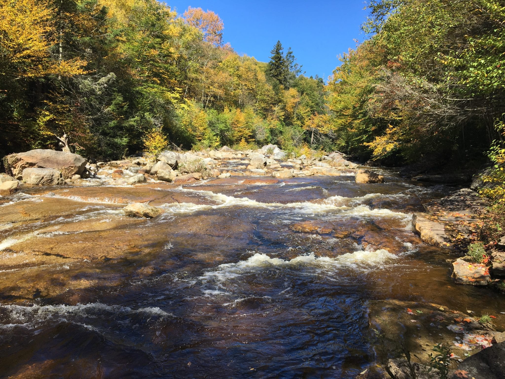
Fisher Spring Run Trail is a great option for nature viewing. The trail is mostly cool and shady, providing beautiful views of West Virginia fall foliage as the leaves change in the fall. The trail is also located near a small downhill stream and runs past small creeks and waterfalls. The trail intersects with Rohrbaugh Trail and the Red Creek.
Take your next hiking adventure—check out the best places to stay in Monongahela National Forest.
Learn more about our cabins near Dolly Sods!
Rocky Ridge Trail
Distance: 3.2 miles
Difficulty: Easy to Moderate
Max Elevation: 4,156 feet
Sitting at an altitude of 3,930 feet and reaching a max elevation of 4,167 feet is the Rocky Ridge Trail within Dolly Sods Wilderness. For about 3.5 miles, hikers will follow the ridge which will provide some of the best views of the Dolly Sods Wilderness. This trail is considered easy to moderate and offers plenty of views and potential wildlife viewing. Rocky Ridge Trail connects with several other Dolly Sods hikes, including Blackbird Knob Trail and Harman Trail.
Rohrbaugh Trail
Distance: 3.6 miles
Difficulty: Easy to Moderate
The Rohrbaugh Trailhead begins at the Dolly Sods picnic area in the southeast and winds its way north 3.6 miles towards Wildlife Trail and Fisher Spring Run. The trail features several scenic views, including beaver dams, flowing creeks, and lush meadows. Connect with either Wildlife Trail or Fisher Spring Run to extend this scenic hike. Rohrbaugh Trail is suitable for all skill levels.
Big Stonecoal Trail
Distance: 4.3 miles
Difficulty: Moderate to Difficult
Max Elevation: 3,902 feet
Big Stonecoal trail traverses 4.3 miles through thick forest, flowing springs, and other natural formations along the south end of Dolly Sods Wilderness. The trail follows Stonecoal Run for a large portion of the hike until it empties into Red Creek. This trail is suited for skilled hikers, with a higher difficulty than other Dolly Sods hikes. Dogs are allowed on Big Stonecoal Trail and don’t have to be leashed.
Blackbird Knob
Distance: 4.7 miles
Difficulty: Moderate
Max Elevation: 4,067 feet
This longer hike boasts stops by some of Dolly Sods’ major attractions, including waterfalls, swimming holes, and beautiful vistas of the valleys and highlands. The trail features a little of everything. If you begin your hike from the east trailhead, you’ll eventually connect with the Rocky Ridge Trail. The west trailhead connects with Big Stonecoal and Breathed Mountain trailhead. Dogs are allowed on Blackbird Knob Trail but must be leashed.
 Red Creek Trail
 Red Creek Trail
Distance: 6.4 miles
Difficulty: Moderate to Difficult
Max Elevation: 3,845 feet
Encompassing 6.4 miles from Red Creek trailhead to Blackbird Knob, Red Creek Trail is by the far the longest hike in Dolly Sods. Red Creek Trail boasts several scenic wonders, including waterfalls, flowing creeks, valleys, and more. Several other trails connect with Red Creek, including Big Stonecoal and Breathed Mountain. After 6.4 miles, Red Creek Trail connects with Blackbird Knob Trail. Due to the length of the trail and some difficult climbs, Red Creek Trail is cited as an intermediate to hard hike. Dogs can also use the trail but must be leashed.
Frequently Asked Questions About Dolly Sods Hiking
How long of a hike is Dolly Sods?
The Dolly Sods Loop is about 23 miles, and how long it takes to hike that distance depends on the hiker, weather conditions, and other factors. Dolly Sods Wilderness is home to over 40 miles of hiking trails, with a range of individual hikes that take anywhere from half an hour to a few days to complete.
What is the best loop in Dolly Sods?
The best loop in Dolly Sods is up to you! The most popular loops in Dolly Sods are Bear Rocks and Lions Head Loop and the Rocky Knob Loop.
What is special about Dolly Sods?
Dolly Sods Wilderness in West Virginia is home to unique bog and heath ecotypes that are typical of areas much farther north than the Mountain State. The stunted red spruces, natural cranberry bogs and huckleberry fields, and sphagnum bogs that characterize Dolly Sods aren’t found elsewhere in the US, and are more common in southern Canada.
Are there bears in Dolly Sods Wilderness?
There are absolutely bears in Dolly Sods Wilderness. They are typically shy and fearful of humans, but visitors to Dolly Sods should take all recommended precautions against bears, like carrying bear spray, locking food in an approved container, and staying vigilant while outdoors.
What makes Dolly Sods so special for hiking?
Dolly Sods, or Dolly Sods Wilderness, is home to a unique ecosystem of bog and heath, rocky plains, and gorgeous vistas at elevations ranging from 2,500 to over 4,000 feet. Here, travelers will find several day hike trails that wind through unique plant communities and offer incredible mountain views.
What town is closest to Dolly Sods?
Petersburg, West Virginia is the closest town to Dolly Sods. Petersburg is also just 10 miles from Harman’s Luxury Log Cabins.